Angelus Hut Tracks
St Arnaud
Mt Robert Carpark, Mt Robert Road, St Arnaud 7072
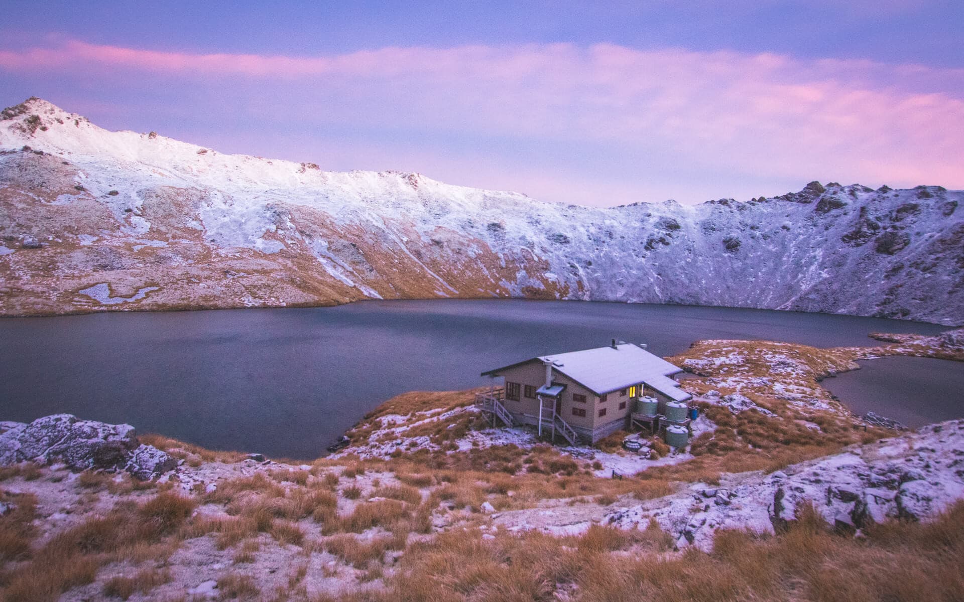
Perched at 1,650 metres, Angelus Hut overlooks Lake Angelus and is surrounded by stunning mountain vistas. From May to October, the lake often freezes, and snow covers all four routes, sometimes requiring visitors to dig their way to the hut.


High up in the mountain ranges above Lake Rotoroa and Rotoiti, reaching Lake Angelus is no easy feat.
Pinchgut/Robert Ridge Route
Although the lake has four access points, the Pinchgut/Robert Ridge route is the most popular and takes approximately 9 hours to complete. It’s a steep climb up Pinchgut Track, zig-zagging through regenerating beech forest to the top of Mount Robert, where a picnic bench overlooks Lake Rotoiti, cradled in its forested basin.
After experiencing the rapid ascent of Pinchgut, the journey along Robert Ridge will seem relatively gentle as you follow a series of markers along the crumbling mountain-top terrain. Exposed to the elements, the challenge of the open ridge is not to be underestimated, as the high wind often battles the stability and endurance of even the most experienced hikers.
Two glistening alpine tarns are revealed as you approach Lake Angelus from above, inviting those brave enough to dip in the glacial waters, commemorating their arrival at their destination. Depending on the time of year, the 28-bunk lakeside hut is the perfect place to warm up before a crackling fire and take a short stroll up the hill to enjoy the beauty of the sunset. From Sunset Saddle, it’s a short, steady climb up Mount Angelus to a height of 2075m, although the views of the departing sun are equally spectacular from the hut's balcony.
Speargrass Track
Speargrass Track is a popular exit route for visitors to Lake Angelus. It follows the valley down to Speargrass Creek and is also the recommended route when weather conditions along the ridgeline are unfavourable. Tussock fields, mini waterfalls, and rolling hills offer a slightly different take on the rugged scenery discoverable along Robert Ridge.
Travers-Cascade Track/Route
Anticipate ice and snow during winter and spring. Above the bush edge, the route is marked by poles and cairns. From May to November, the bridge over the Hukere Stream is removed due to avalanche risk. After rain and during snowmelt, crossing the river can be challenging – exercise extreme caution.
Mt Cedric Track/Route
This route is for trampers heading to Angelus Hut via the Travers–Sabine Circuit. Please note that there is no water available along the way. During winter and spring, expect ice and snow. The track involves a steep climb to the bush edge, with navigation above marked by poles and cairns. The ridge is quite exposed, often experiencing high winds and poor visibility.
Note: Between May and October, the lake is usually frozen and snow blankets all four routes. Only experienced hikers with winter hiking equipment should attempt to reach Lake Angelus in winter, as the conditions are incredibly challenging and the risk of avalanches is high.
How to get there: There are four access points to Lake Angelus: the Pinchgut/Robert Ridge route, Speargrass Track, Travers-Cascade route, and Mount Cedrick. The most popular route is Pinchgut, which begins at the Mount Robert carpark in Saint Arnaud.
Weather Considerations
Seasonal restrictions May to October: Additional hazards on all routes to Angelus Hut including snow, ice, avalanche risk and sub-zero temperatures.
Contact details
Address: Mt Robert Carpark, Mt Robert Road, St Arnaud 7072