Mount Arthur Summit Route
Graham Valley Road
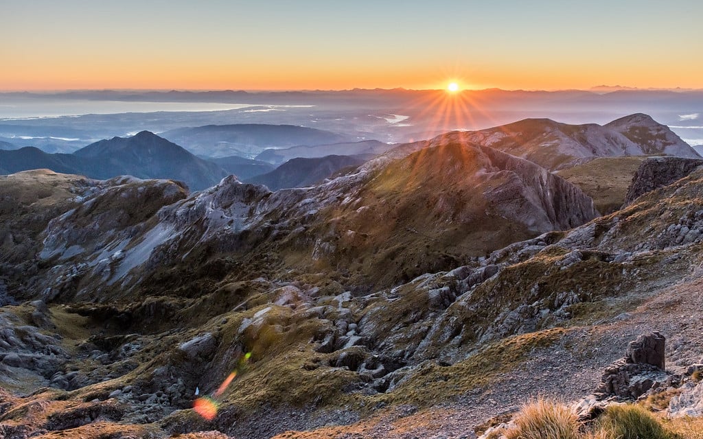
At a height of 1795m, Mount Arthur is the highest peak in the Wharepapa/Mount Arthur Range of the Kahurangi National Park.

It’s a challenging 9.2km day walk along a well-marked and graded track to the summit, but there is also the option of staying overnight in one of the two huts if you have more time to spare.
Starting at the Flora carpark, you’ll journey through dense beech, sheltered from the elements by the towering trees and lush forest canopy that Kahurangi is renowned for. You can traverse the Flora Saddle and down to Flora Hut (30 minutes) or follow the ridge toward Mount Arthur where you’ll discover Mount Arthur Hut along the treeline (1 hour 30 minutes).
The diversity of flora and fauna is apparent in this neck of the woods, and weka, riflemen and bellbird are just a few bird species that thrive in this mossy wonderland. Beech forest gradually transcends into groves of mountain neinei, tussock and sub-alpine scrub, with the low growing species in this alpine environment shaped by harsh winds and winter snowfall.
Glaciated marble outcrops and limestone landscapes surround you on the way to the top, but it’s the views of Kahurangi National Park, Tasman Bay and the neighbouring tablelands that will leave you truly mesmerised by the beauty of this special place.
How to get there: The track begins at the Flora carpark, crossing the Motueka River and connecting with Graham Valley Road. The carpark is unsealed (and very steep), so a 4WD vehicle is recommended.
Contact details
Address: Graham Valley Road